Linking conservation areas across Tasmania’s Central Highlands to create 20,000 hectares of privately protected areas for nature, the Pine Tier property makes a difference at a landscape scale.
A LAND OF RIVERS
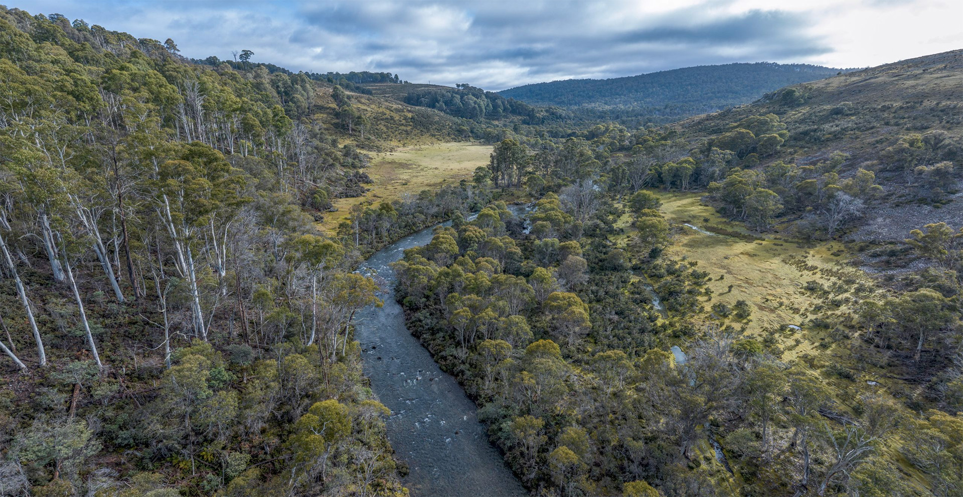
This 1,880 hectare property is at the confluence of five beautiful highland rivers in the Great Lakes region. The Little Pine and Nive rivers pour down from trawtha makuminya, lined with drooping pine, a dwarf alpine conifer that is endemic to Tasmania’s central plateau, west and south-west. Kenneth Creek winds from Skullbone Plains through picturesque valleys cushioned with large sphagnum peat bogs. The Little Pine enters the Pine and, at the property’s southern boundary, flows into Pine Tier Lagoon, much of which is already surrounded by TLC reserve.
The Pine and Little Pine rivers converge in the geographical centre of Tasmania. At an elevation of 800m on a crisp clear highland day, you can gaze from the basalt dome above these two rivers south to the snow-capped peaks of the Franklin–Gordon Wild Rivers National Park and north into the Walls of Jerusalem National Park.


GRASSLANDS, SEDGELANDS AND PEATLANDS
More than 70% of Pine Tier is comprised of threatened vegetation communities, particularly threatened grasslands, sedgelands and peatlands, which together cover 1,400 hectares of this property. These communities are frequently under pressure and threats from degradation and further agricultural development.
Highland Poa grassland promises important habitat for the threatened ptunarra brown butterfly. Pine Tier will protect this grassland and the threatened Highland grassy sedgeland. These communities are frequently under pressure and threats from degradation and further agricultural development.
Sphagnum peatland, a nationally endangered vegetation community, plays a crucial role in the global carbon cycle as a vital carbon sink, with peatlands storing more carbon than all other forest vegetation types. Protecting Pine Tier’s exquisite Sphagnum peatlands contributes to an important source of carbon sequestration.
This landscape is a stronghold for animals only found in the wild in Tasmania. Eastern quolls bound from the safety of forests into highland grasslands to hunt for prey: ecotones between forest and grasslands provide important habitat for these marsupial carnivores. Pine Tier is also habitat for the endangered Tasmanian devil and for the spotted tail quoll. Swift parrots can be seen here, foraging among the flowering eucalypts late in the season as the begin their journey north, while regenerating forest provides nesting sites for wedge-tailed eagles and masked owls.

CONSERVATION AT A LANDSCAPE SCALE
The protection of Pine Tier will create a staggering 20,000 hectares of privately protected areas, the largest in Tasmania: from Five Rivers Reserve in the east, to trawtha makuminya in the north, owned and managed by the Tasmanian Aboriginal community, and out to Skullbone Plains, providing an important buffer to the Tasmanian Wilderness World Heritage Area in the west.
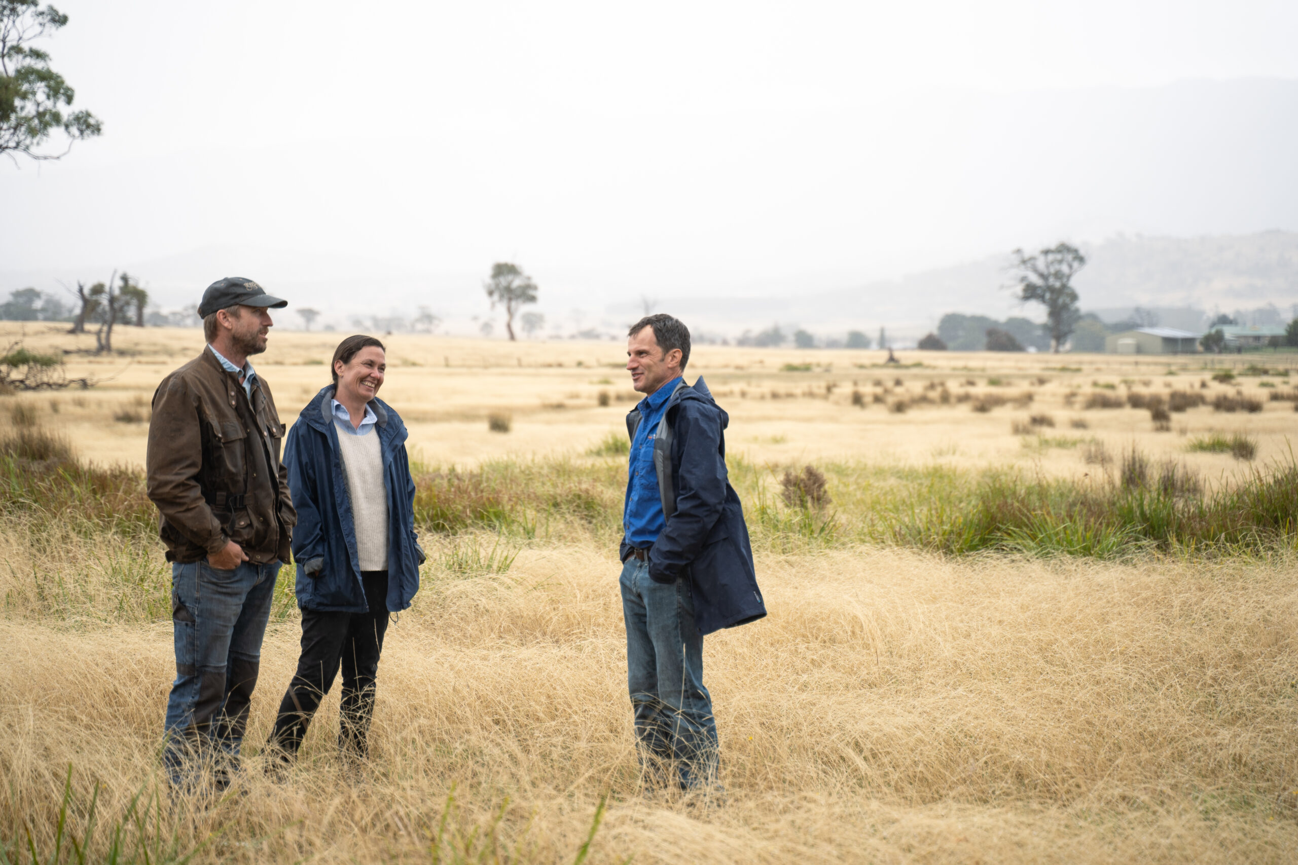
This is a critically strategic opportunity to increase Australia’s reserve estate and maximise connectivity between protected areas by being able to plan, manage and monitor at a landscape scale. So many of the threats that affect nature’s future are not contained by fences. Managing weeds, fire, and invasive species like fallow deer is infinitely more effective when it is done across an entire landscape. Creating such a large conservation estate means tipping the balance in favour of nature, more critical than ever in a changing climate. Together with the community, we’ll be connecting forest woodlands and grassland valleys rich in biodiversity.


